World Stroll
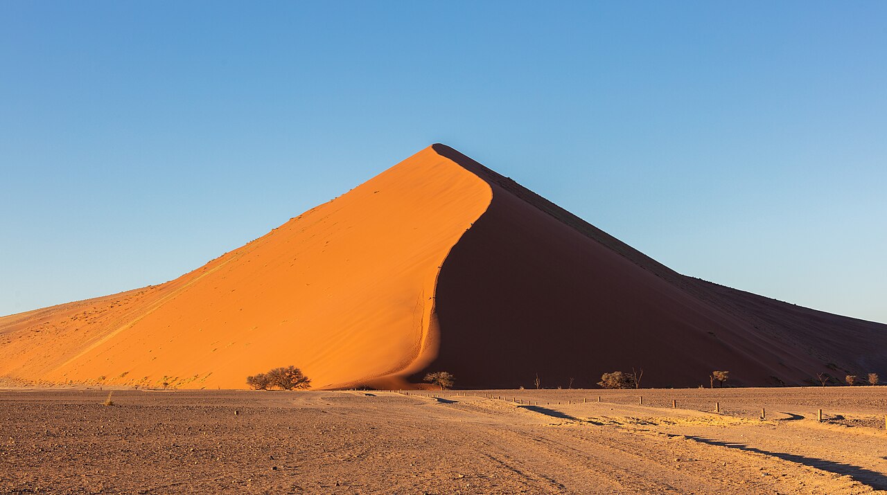
Commons: Sossusvlei
Photo: Diego Delso, CC BY-SA 4.0
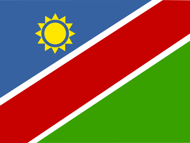
Flag of Namibia
Southern Africa

Namibia

Red dunes above a foggy Atlantic coast, desert elephants and cheetahs, and a young nation that won its independence in 1990.
Your trip to Namibia

Ready for the trip?

10 questionsAbout 3 minutesNo timer
Explore Namibia
You have explored 0 of 9 parts. Scroll on to discover the rest.
AngolaBotswanaComorosDR CongoEswatiniLesothoMadagascarMalawiMauritiusMozambiqueNamibiaSaint Helena, Ascension and Tristan da CunhaSouth AfricaTanzaniaZambiaZimbabwe

Neighbours

Going to Namibia?Phrases, table manners and local tips on one printable page. Send a postcard from NamibiaA free digital postcard for family and friends.
Overview

Namibia at a glance

Namibia lies on the Atlantic coast of southwestern Africa, between Angola and South Africa. Its name comes from the Namib, the coastal desert that runs the whole length of its shore, where cold sea fog drifts over some of the tallest sand dunes on Earth. Inland rise a high central plateau, rocky mountains and, in the east, the red sands of the Kalahari. The far northeast, along the narrow Caprivi Strip, is the greenest and wettest part of the country.

People have lived here for tens of thousands of years: San hunter-gatherers and Khoekhoe herders left rock engravings and paintings across the country, and Bantu-speaking farmers and cattle keepers such as the Ovambo and Herero arrived later. Germany made the territory a colony in 1884, and between 1904 and 1908 German troops killed tens of thousands of Herero and Nama people. South Africa then ruled the land as South West Africa and imposed apartheid, until a long struggle and a United Nations plan brought independence on 21 March 1990.

Today Namibia has about 3 million people in an area more than three times the size of the United Kingdom, which makes it one of the most thinly populated countries in the world. It is a peaceful democracy known for its wildlife, its desert landscapes and its many languages. Visitors come for the dunes of Sossusvlei, the animals of Etosha, the German-era towns of the coast and long drives on empty gravel roads.

CapitalWindhoek
PopulationAbout 3 million (2023 census: 3,022,401)
Official languageEnglish, although only a few percent of Namibians speak it at home. Oshiwambo is the most common home language, and Afrikaans, Khoekhoegowab, the Kavango languages, Otjiherero, Silozi and German are also widely spoken
CurrencyNamibian dollar (NAD), divided into 100 cents and worth the same as the South African rand, which is also legal tender
AreaAbout 825,615 km²
GovernmentRepublic with a President elected directly by the voters for five-year terms, and a Parliament of two houses. The country is divided into 14 regions
Highest mountainKönigstein, the summit of the Brandberg massif, about 2,573 m
Longest riverThe Orange, about 2,400 km long, which forms the southern border with South Africa. All of Namibia's rivers that flow all year run along its borders
NeighboursAngola, Zambia, Botswana and South Africa. In the far northeast Zimbabwe lies less than 200 m away across the Zambezi
Drives on theLeft
Calling code+264
Next: Story

The story

A short history of Namibia

Namibia's dry lands have been home to San and Khoekhoe peoples for thousands of years, and rock slabs painted about 30,000 years ago in the Apollo 11 Cave are among the oldest figurative art in Africa. Bantu-speaking peoples arrived from around the 14th century, and Ovambo kingdoms grew up in the north. In the 1800s missionaries, traders and Oorlam groups from the Cape came in, and in 1884 Germany made the territory its colony. German rule brought war and genocide; South African rule after 1915 brought apartheid. The long struggle for independence ended in 1990.

  1. 1840

    Jonker Afrikaner settles at Windhoek

    Jonker Afrikaner, leader of the Oorlam people who had come north from the Cape, settled with his followers by the hot springs of Windhoek and built a stone church there that held 500 people. The first known written mention of the name Windhoek is in a letter he wrote in 1844.

  2. 1884

    Germany claims the territory

    On 24 April 1884 Germany placed the land bought by the Bremen merchant Adolf Lüderitz at Angra Pequena, today's Lüderitz, under its protection, and the German flag was raised there in August. The colony became German South West Africa. The harbour of Walvis Bay stayed British, as part of the Cape Colony.

  3. 1904

    The Herero and Nama genocide

    On 12 January 1904 the Herero rose up against German rule, and the Nama followed later that year. German troops under General Lothar von Trotha answered with a campaign of extermination: after the Battle of Waterberg in August 1904 many Herero were driven into the Omaheke desert, where large numbers died of thirst, and survivors were held in camps where about half the prisoners died. By 1908 around 80 percent of the Herero and half of the Nama had died.

  4. 1907

    Etosha becomes a game reserve

    In March 1907 the German governor proclaimed a large game reserve around the Etosha Pan. It became Etosha National Park in 1967 and is still Namibia's best-known wildlife park.

  5. 1908

    Diamonds are found near Lüderitz

    In 1908 the railway worker Zacharias Lewala found a diamond in the sand near Lüderitz and showed it to his supervisor, August Stauch. A diamond rush followed, the town of Kolmanskop grew up in the desert, and Germany closed off a vast area of the coast as the Sperrgebiet, the 'forbidden area'.

  6. 1915

    South Africa takes control

    During the First World War South African troops invaded the colony, and the German forces surrendered near Khorab on 9 July 1915. In 1920 the League of Nations gave South Africa a mandate to govern the territory, which it ran as South West Africa and later placed under apartheid laws.

  7. 1960

    SWAPO is founded

    On 19 April 1960 the South West Africa People's Organisation, SWAPO, was founded to campaign for the end of South African rule. As of 2026, it has governed Namibia ever since independence.

  8. 1966

    The armed struggle begins

    On 26 August 1966 South African forces attacked a SWAPO camp at Omugulugwombashe in the north, the first major clash of a war that lasted until independence. Namibians remember the day as Heroes' Day.

  9. 1978

    UN Resolution 435

    On 29 September 1978 the United Nations Security Council adopted Resolution 435, a plan for a ceasefire and UN-supervised elections leading to independence. It was carried out only after South Africa, Angola and Cuba signed the Tripartite Accord in December 1988.

  10. 1989

    The first free election

    From 7 to 11 November 1989 Namibians of all backgrounds voted together for the first time, under United Nations supervision, and just over 97 percent of registered voters took part. The Constituent Assembly they elected wrote the Constitution, adopted in February 1990.

  11. 1990

    Independence

    On 21 March 1990 Namibia became independent, the new flag was raised, and Sam Nujoma was sworn in as the first President in front of guests from around the world, among them Nelson Mandela, released from prison the month before. 21 March is Independence Day.

  12. 1993

    The Namibian dollar arrives

    On 15 September 1993 the Bank of Namibia issued the first Namibian dollar banknotes. The new currency replaced the South African rand at the same value, and the rand remains legal tender alongside it.

  13. 1994

    Walvis Bay returns

    On 1 March 1994 South Africa handed Walvis Bay, the country's only natural deep-water harbour, and the small Penguin Islands over to Namibia. They had stayed under South African control after independence.

  14. 2021

    Germany recognises the genocide

    On 28 May 2021, after more than five years of talks with Namibia, Germany's foreign minister said that Germany would now officially call the events of 1904 to 1908 a genocide and would ask Namibia and the descendants of the victims for forgiveness. German officials had already used the word genocide in 2015. Germany offered 1.1 billion euros for development over 30 years. Many Herero and Nama leaders reject the deal, saying they were left out of the talks.

Next: At the table

At the table

What to eat in Namibia

Namibian food follows two main paths. In the north, where most people live, the day's meal is oshifima, a stiff porridge of pearl millet or maize, eaten by hand with a relish of meat, wild spinach, dried fish or mopane worms. Across the whole country meat is plentiful, because the dry land is better for cattle, goats and sheep than for crops: it is grilled on the street as kapana, cooked for hours in a three-legged pot, or dried as biltong. German and Afrikaner settlers added dishes such as schnitzel and potjiekos, and the rains bring wild treats such as giant termite-hill mushrooms and Kalahari truffles.

Commons: Kapana
Photo: Fdimolloy, CC BY-SA 4.0
Main courseRecipe

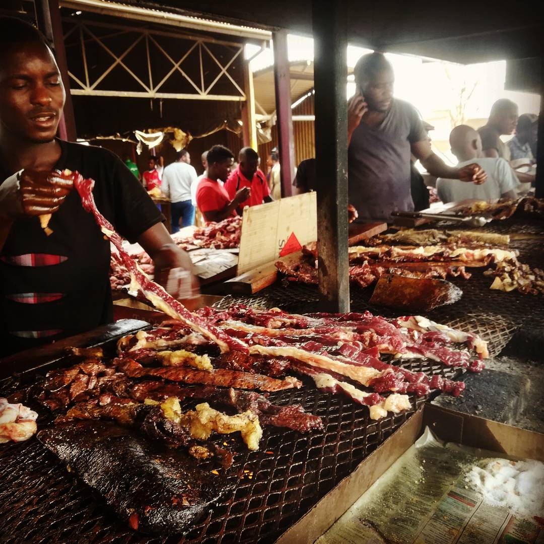
Kapana

Windhoek, especially the Katutura township, and markets across Namibia

Small pieces of beef grilled on a hot metal plate over a wood fire at open-air markets, sold straight from the grill. It is dipped in a spice mix and eaten with a fresh salsa of onion, tomato and chilli, often with fat cakes. If you do not like it hot, say so.

The price is usually open to bargaining, and the traders compete noisily, each shouting that his meat is the best.

See the recipe
Serves 4 30 min

Ingredients

  • 600 g tender beef (sirloin or rump), cut into bite-sized pieces
  • 2 tablespoons oil
  • 2 teaspoons braai or barbecue spice, or salt, black pepper, paprika and a pinch of chilli
  • For the salsa: 1 onion, 2 tomatoes, 1 small green chilli (optional), 2 tablespoons oil, 1 tablespoon white vinegar and salt

Method

  1. Make the salsa: chop the onion, tomatoes and chilli finely and mix with the oil, vinegar and a pinch of salt.
  2. Heat a heavy frying pan, griddle or barbecue plate until very hot, and brush it with the oil.
  3. Lay the beef pieces on the hot surface in one layer and cook for 5 to 10 minutes, turning them, until browned outside.
  4. Put the spice mix in a small bowl. Dip each piece in the spice and eat it with a spoon of salsa, with fat cakes or bread.
Commons: Oshifima
Photo: Manshoti, CC BY-SA 4.0
Side dishRecipe

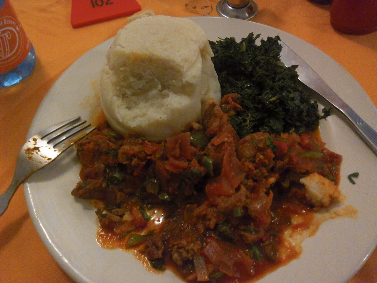
Oshifima

oshifima (Oshiwambo)
Northern Namibia, from Ovambo cooking

A stiff porridge made from mahangu (pearl millet) flour, maize meal or a mix of both, and the most important food in the north. A small piece is pinched off with the right hand, shaped with the fingers and used to scoop up meat, spinach or sauce.

Mahangu grows well in the hot, dry north where other grains fail, and the harvest is stored in large woven baskets lined with clay.

See the recipe
Serves 4 25 min

Ingredients

  • 1 litre water
  • About 300 g pearl millet (mahangu) flour, maize meal, or a mix of both
  • A pinch of salt (optional)

Method

  1. Bring the water to the boil in a heavy pot, with the salt if you use it.
  2. Sprinkle in about a third of the flour while stirring hard with a wooden spoon, to make a thin porridge. Let it bubble for 2 or 3 minutes.
  3. Add the rest of the flour a little at a time, stirring and pressing the mixture against the side of the pot, until it is thick, smooth and pulls away from the pot.
  4. Cover and leave on a very low heat for 5 minutes. Shape into a mound with a wet spoon and serve with meat, wild spinach or a stew.
Commons: omboga
Photo: Gwasheya, CC0
Side dish

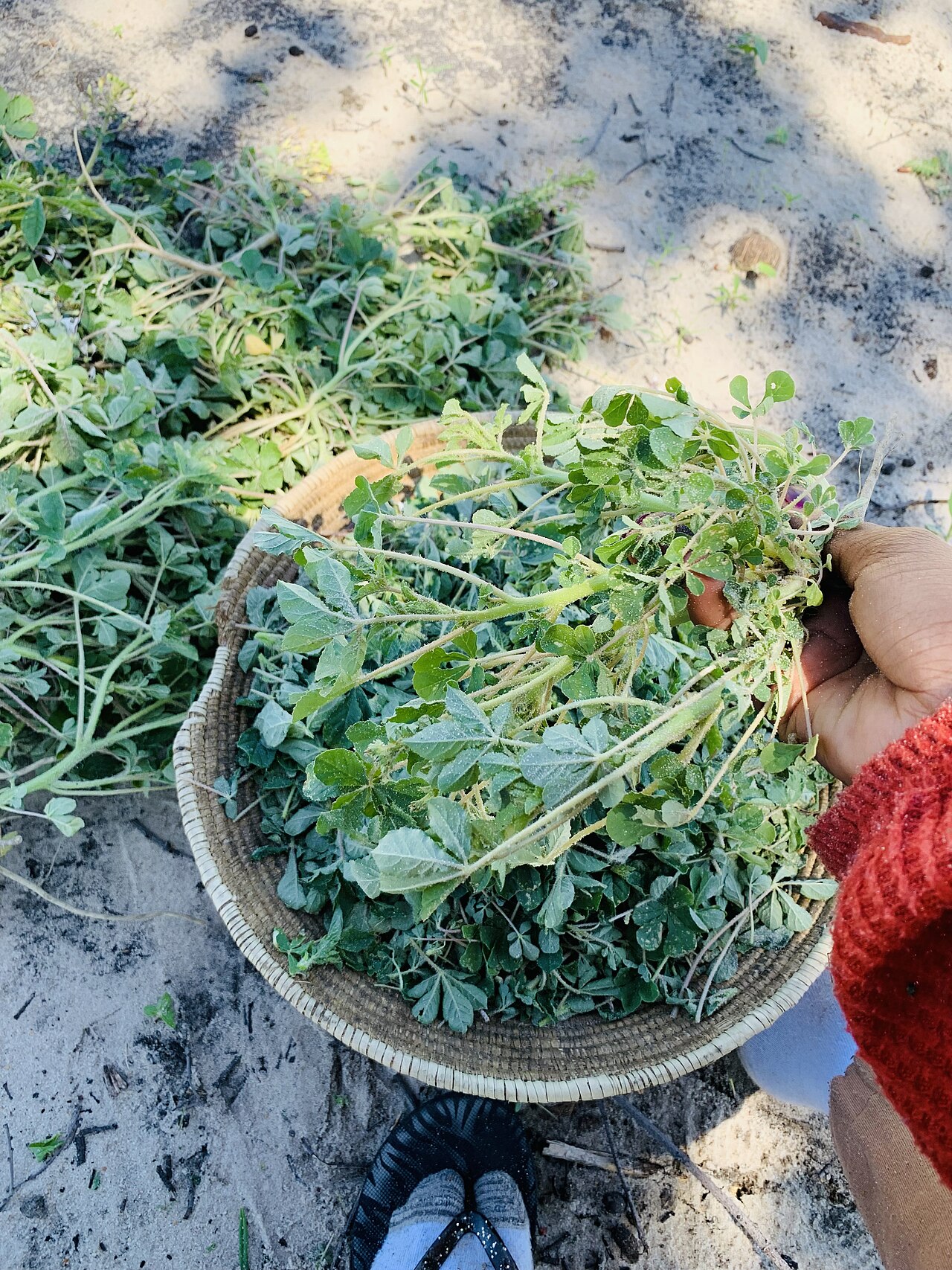
Wild spinach

omboga
Northern Namibia

Leafy greens that grow wild in the mahangu fields, cooked as a relish to eat with oshifima. The leaves are also dried to keep for the dry months.

Travellers are warned that it often stays a little sandy, however well it is washed.

Commons: Mopane worms Namibia
Photo: Ilka Nghinamupika, CC BY-SA 4.0
Snack

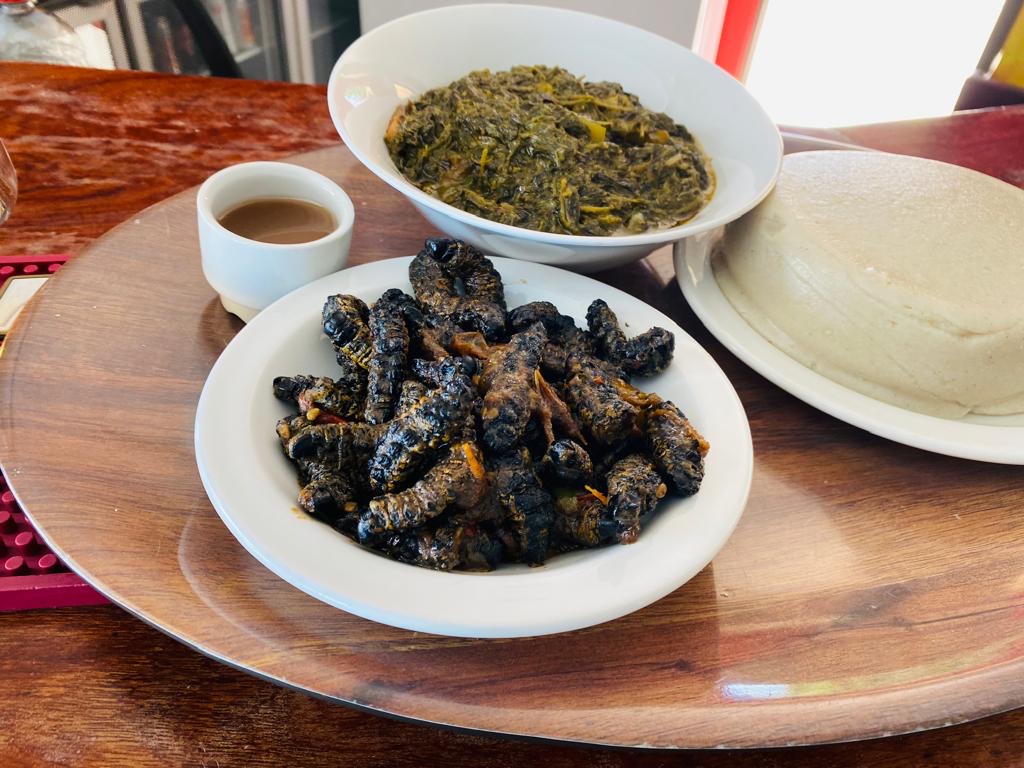
Mopane worms

Northern and northeastern Namibia, and much of southern Africa

The large caterpillars of the mopane emperor moth, picked from mopane trees after the rains, boiled in salt water and dried in the sun. They are eaten as a crunchy snack or soaked and cooked with onion, tomato and chilli to serve with porridge. They are rich in protein and sold dried at northern markets such as Oshakati's.

About three kilograms of mopane leaves make one kilogram of worms, far less feed than cattle need for the same weight of beef.

Kalaharituber
Photo: de:Benutzer:Chtrede, CC BY-SA 3.0 de
Side dish

Kalahari truffles

nabbas
The Kalahari in eastern Namibia

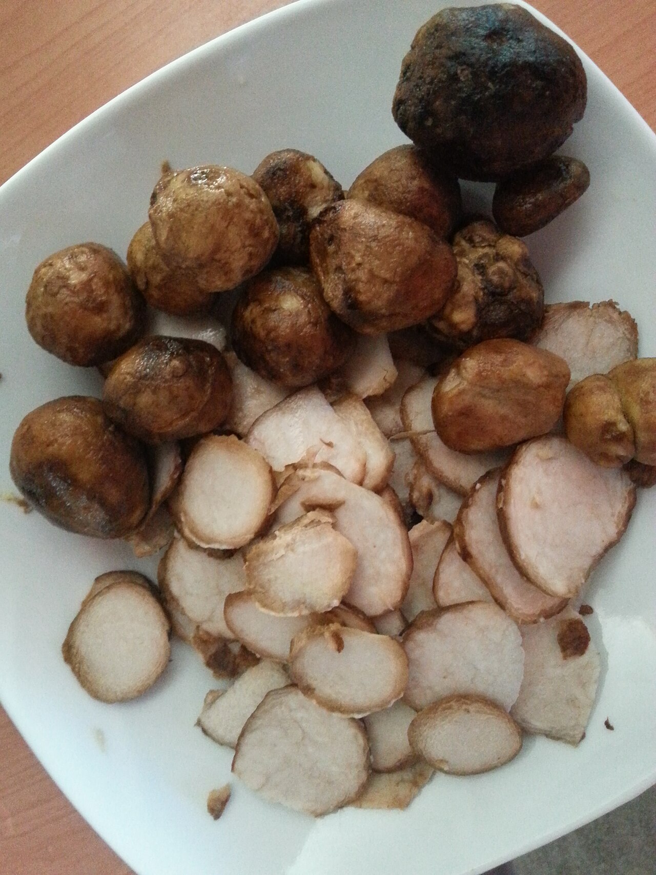
Wild desert truffles, up to about 12 cm across, that grow just under the sand after good rains and are found by the cracks they make in the ground. They have long been gathered and eaten by the San and other peoples of the Kalahari.

Termitomyces schimperi
Photo: Chtrede at de.wikipedia, CC BY-SA 3.0
Side dish

Omajowa mushrooms

omajowa (Otjiherero)
Central and northern Namibia

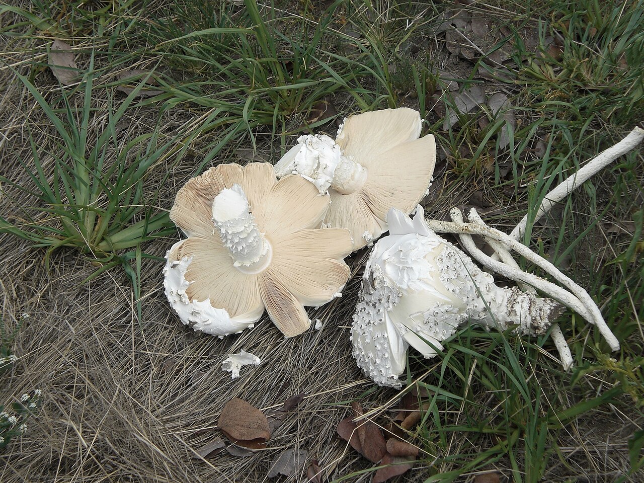
Huge white mushrooms that push up around termite mounds after heavy summer rains, mostly from January to March. The caps can grow to 40 cm across. They are sold at the roadside and fried or grilled while fresh.

Namibians see them as a symbol of growth and prosperity.

Biltong
Photo: Delia du Plessis, CC BY-SA 3.0
Snack

Biltong

All of Namibia, shared with South Africa

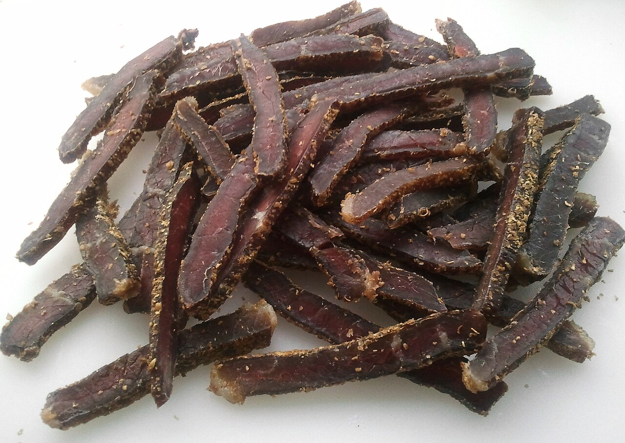
Strips of beef or game such as kudu or oryx, cured with salt, vinegar and spices and air-dried for several days. Namibians take it, and droewors (dried sausage), on long road trips. Because it is raw meat that is cured and dried rather than cooked, pregnant women are advised to avoid it.

Potjiekos
Photo: EKK Events, CC BY-SA 4.0
Main courseRecipe

Potjiekos

All of Namibia, from Afrikaner cooking

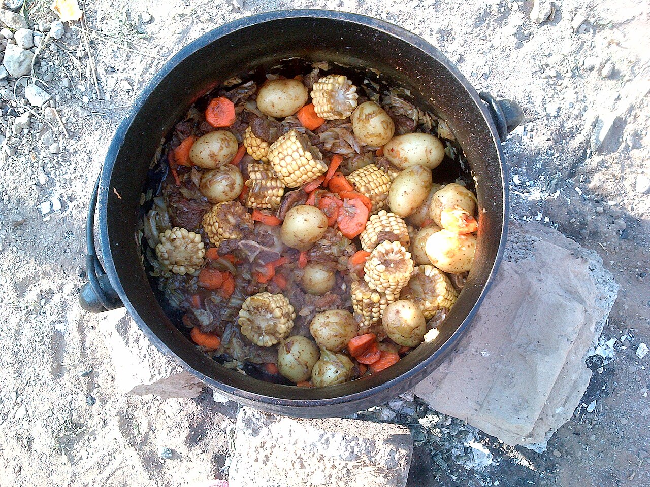
A stew of meat, vegetables and potatoes cooked slowly over a small fire in a three-legged cast-iron pot, the potjie. Lodges often cook one for their guests, and a host may make one for a special visit.

The name means 'small-pot food' in Afrikaans.

See the recipe
Serves 6 3 h

Ingredients

  • 2 tablespoons oil
  • 1.5 kg lamb, goat or beef on the bone, cut into pieces
  • 2 onions, chopped, and 2 cloves garlic, crushed
  • 2 teaspoons paprika, salt and pepper
  • 500 ml beef stock
  • 4 carrots, in thick slices
  • 500 g potatoes, peeled and halved
  • 250 g butternut squash or pumpkin, in chunks
  • 150 g green beans or mushrooms

Method

  1. Heat the oil in a cast-iron pot over a fire or on the stove, and brown the meat in batches. Add the onions and garlic and fry until soft.
  2. Add the paprika, salt, pepper and stock, cover and simmer very gently for 1 to 1.5 hours, until the meat is nearly tender.
  3. Lay the vegetables on top in layers: carrots and potatoes first, then squash, then beans or mushrooms. Do not stir.
  4. Cover again and simmer for about 1 hour more, adding a little water if it runs dry, until the vegetables are soft. Serve straight from the pot with rice or bread.
Vetkoek
Photo: NJR ZA, CC BY-SA 3.0
BreadRecipe

Fat cakes

vetkoek (Afrikaans), oukuki (Oshiwambo)
All of Namibia

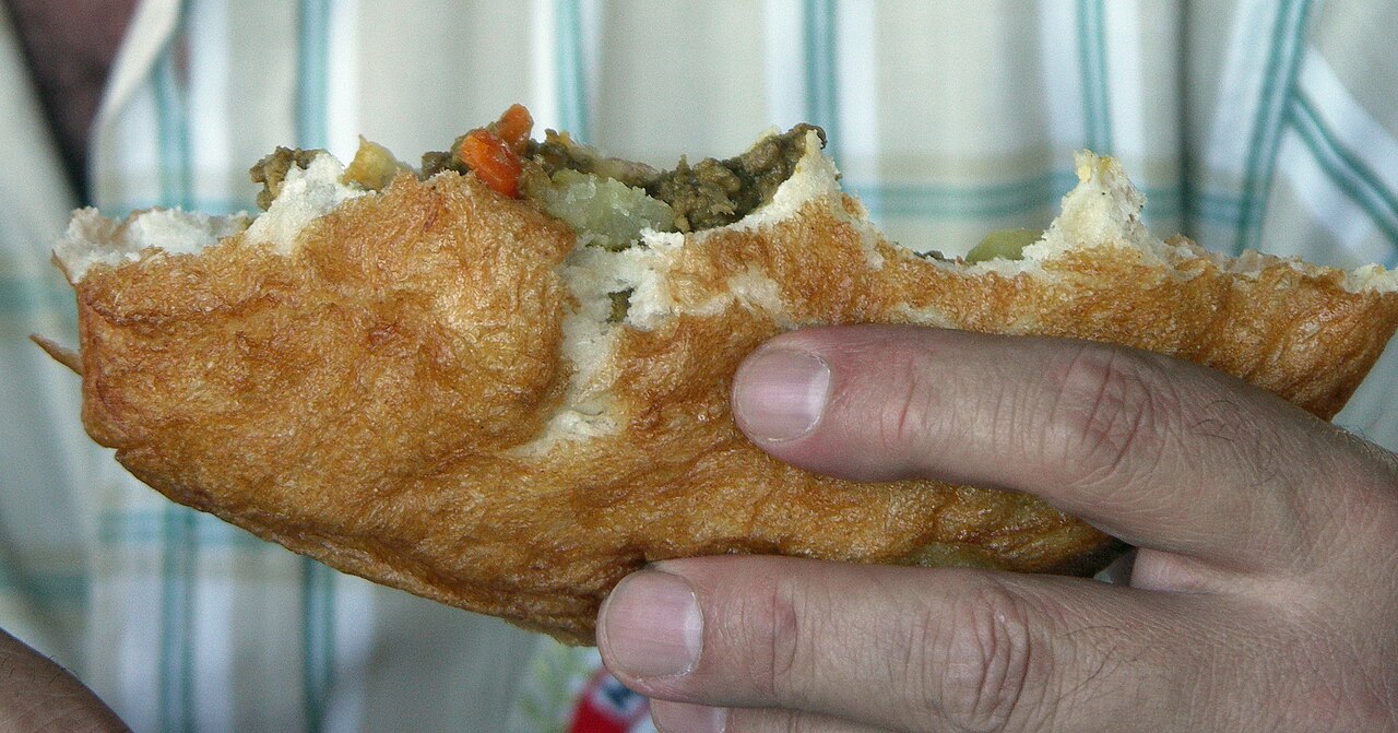
Balls of yeast dough deep-fried until golden, sold by street vendors all over the country. In Namibia they are also called 'junkies'. They are eaten with kapana, split and filled with mince, or with jam.

Vetkoek means 'fat cake' in Afrikaans.

See the recipe
Serves 6 1 h 30 min

Ingredients

  • 500 g plain flour
  • 1 packet (10 g) instant dried yeast
  • 1 tablespoon sugar and 1 teaspoon salt
  • About 350 ml lukewarm water
  • Oil for deep-frying

Method

  1. Mix the flour, yeast, sugar and salt in a bowl. Add the water a little at a time and mix to a soft dough.
  2. Knead for 5 minutes, cover and leave in a warm place for about 1 hour, until doubled in size.
  3. Pinch off pieces the size of a small egg and roll them into balls.
  4. Heat the oil in a deep pan to about 170 °C and fry a few balls at a time for 3 to 4 minutes, turning, until golden and cooked through. Drain on kitchen paper. Never leave hot oil unattended.
Commons: Marathon chicken
Photo: Ilka Nghinamupika, CC BY-SA 4.0
Main course

Marathon chicken

Owambo chicken
Northern Namibia, from Ovambo homesteads

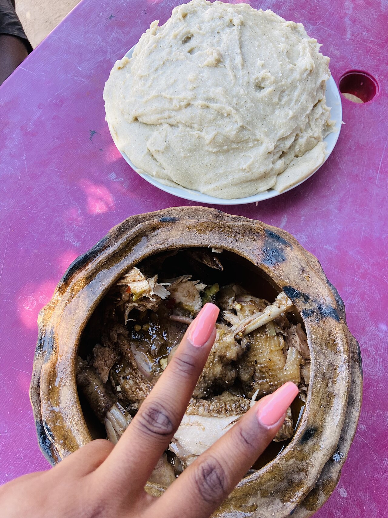
A stew of hardy free-range village chicken, boiled with a little water and salt and then fried in marula oil until tender and golden, a favourite of Ovambo homesteads, where the dish is cooked on an open fire.

The birds are nicknamed 'marathon runners' because they are so quick and wary that catching one means a long chase around the homestead.

Schnitzel
Photo: Benreis, CC BY-SA 3.0
Main course

Schnitzel

Windhoek, Swakopmund and German-Namibian homes, from German settlers

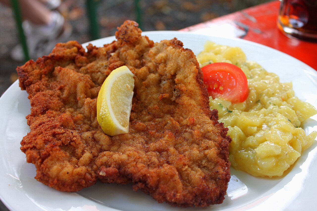
A thin slice of veal or pork, coated in breadcrumbs and fried golden, served with a lemon wedge and potatoes. It is one of the best-known dishes of German-Namibian cooking and appears on many restaurant menus.

Commons: Oshikundu
Photo: Greg Willis from Arlington, VA, usa, CC BY-SA 2.0
Drink

Oshikundu

ontaku
Northern Namibia and the Kavango region

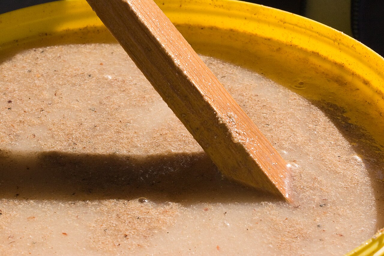
A thick, brown drink made from mahangu flour, bran and malted sorghum mixed with warm water and left to ferment for a few hours. It is sold at markets and roadside stalls and must be drunk within about six hours, before it turns sour.

Table manners

  • Wash your hands before eating.
  • Eat oshifima with your right hand only: pinch off a piece, shape it with your fingers and use it to scoop up the relish.
  • It is rude to refuse food outright. If you cannot eat more, decline politely, for example by saying you are full because you have just eaten.
  • A host who offers home-made food or drink often tastes it first in front of you, to show that it is good.
  • At kapana stalls and open markets the price is often open to friendly bargaining, but in shops and restaurants prices are fixed.

Next: Cities

Cities

12 cities to know

Most Namibians live either in the green far north, near the Angolan border, or in Windhoek in the centre. The coast has only a few towns, cut off from the interior by the Namib, while the south is a land of huge sheep farms and small towns far apart. Distances are long: it is about 350 km by road from Windhoek to Swakopmund on the coast.

WindhoekWalvis BaySwakopmundLüderitzKeetmanshoopOshakatiRunduKatima MuliloOtjiwarongoTsumebGrootfonteinKhorixas
Windhoek
Photo: Christoph Strässler, CC BY-SA 2.0

Windhoek Capital

Khomas, in the centre

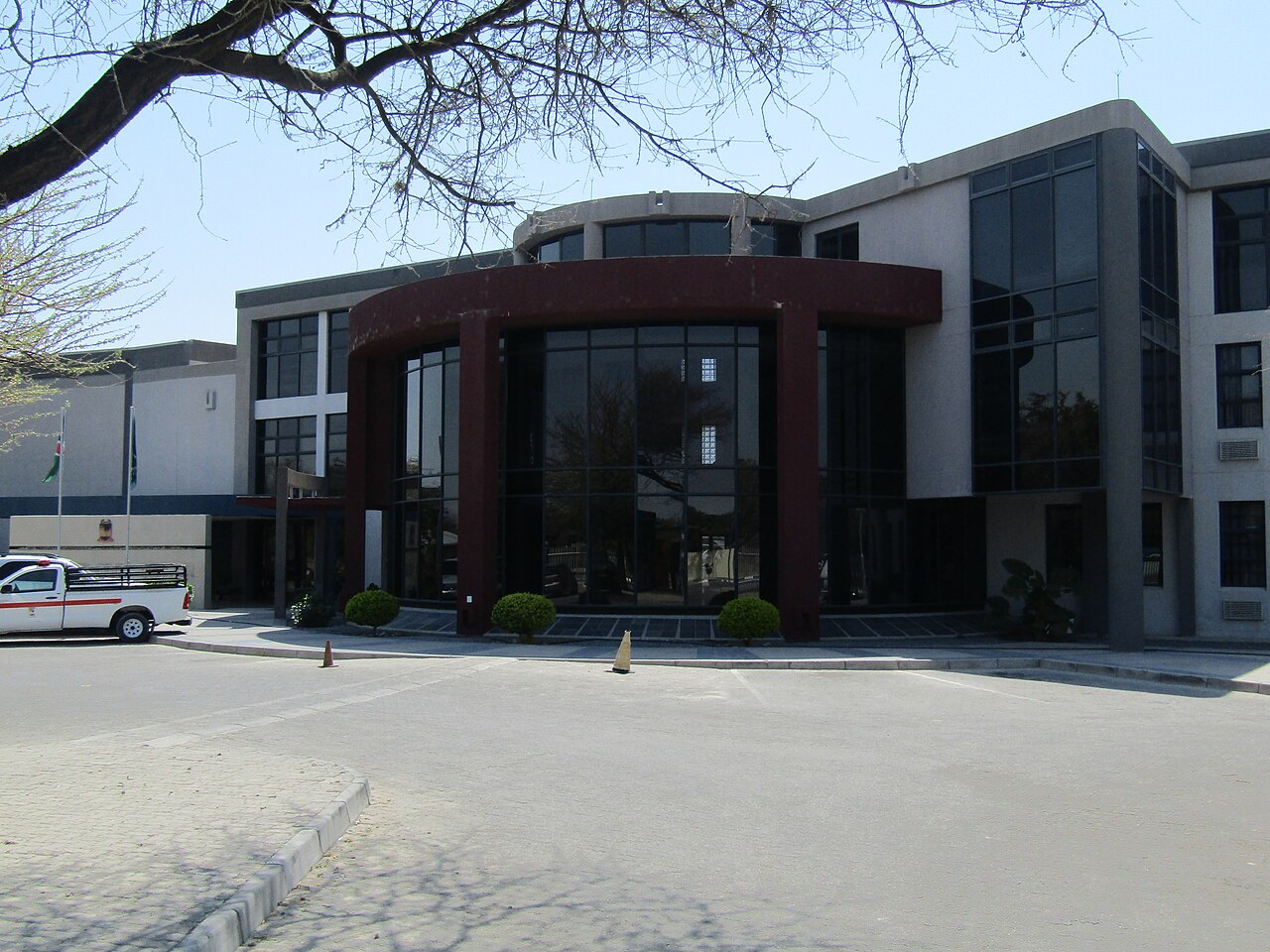
The capital and by far the largest city, with about 486,000 people in 2023. It lies on a highland plateau about 1,700 m above sea level, near the geographical centre of the country, and grew up around hot springs. The German fort built in 1890, the Alte Feste, still stands, and the township of Katutura is famous for its kapana markets.

  • Christ Church and the Tintenpalast, the parliament building
  • The Alte Feste, the old German fort
  • Kapana grills in Katutura
Walvis Bay
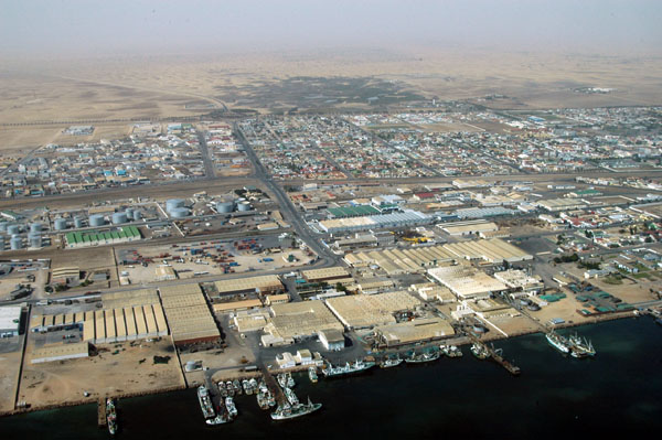
Photo: Brian McMorrow, CC BY-SA 2.5

Walvis Bay

Erongo, on the Atlantic coast

The largest coastal city and Namibia's main port, with about 103,000 people in 2023, sheltered by the sand spit of Pelican Point. It stayed under South African control until 1994, four years after independence. It is known for its abundant birdlife, and dunes rise right behind the town.

  • The only natural deep-water harbour on the coast
  • Birdlife and the artificial Bird Island
  • Dune 7 and the salt works
Swakopmund
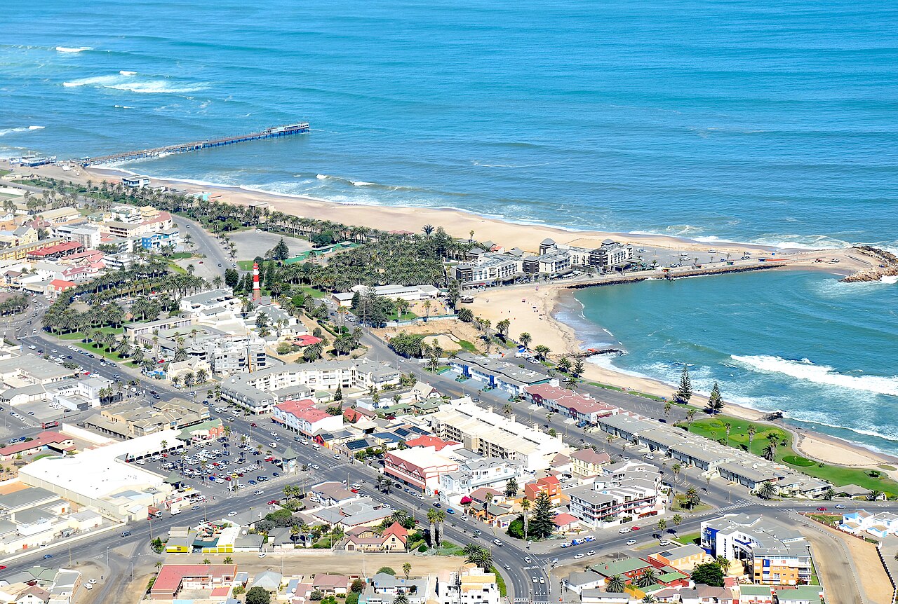
Photo: Olga Ernst, CC BY-SA 4.0

Swakopmund

Erongo, on the Atlantic coast

A seaside town founded in 1892 as the main harbour of German South West Africa, about 30 km north of Walvis Bay. Its German colonial buildings and cool sea air make it a popular beach resort. It had about 76,000 people in 2023.

  • German colonial architecture, such as the Woermannhaus
  • Sandboarding and quad biking in the dunes
  • The jetty and the beach promenade
Lüderitz
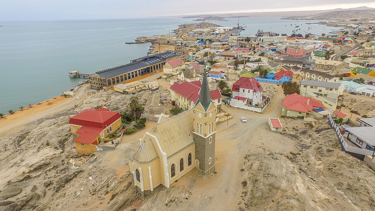
Photo: SkyPixels, CC BY-SA 4.0

Lüderitz

ǁKaras, on the south coast

A small, windy harbour town between the desert and the sea, named after Adolf Lüderitz, whose purchase of the bay in 1883 led to German rule. Its Art Nouveau houses date from the diamond rush after 1908. Just offshore lies Shark Island, the site of a German concentration camp during the genocide.

  • The Felsenkirche, a rock church consecrated in 1912
  • The ghost town of Kolmanskop nearby
  • Seals, penguins and flamingos
Commons: Keetmanshoop city
Photo: Olga Ernst & Hp.Baumeler, CC BY-SA 4.0

Keetmanshoop

ǁKaras, in the south

The main town of the south, with about 28,000 people, on the railway and the main road to South Africa. It began as a Rhenish mission station among the Nama in the 1860s and was named after its German patron, Johann Keetman.

  • The Quiver Tree Forest nearby
  • Karakul sheep farming
  • A base for the Fish River Canyon
Oshakati
Photo: Pemba.mpimaji, CC BY-SA 4.0

Oshakati

Oshana, in the far north

A busy commercial town in the densely settled Ovambo north, founded in 1966 and proclaimed a town in 1992. It had about 59,000 people in 2023. Its open market sells dried fish, mahangu and dried mopane worms.

  • Its large open market
  • Shopping for the whole northern region
  • The flat oshana flood plains around it
Rundu
Photo: Hp.Baumeler, CC BY-SA 4.0

Rundu

Kavango East, on the Angolan border

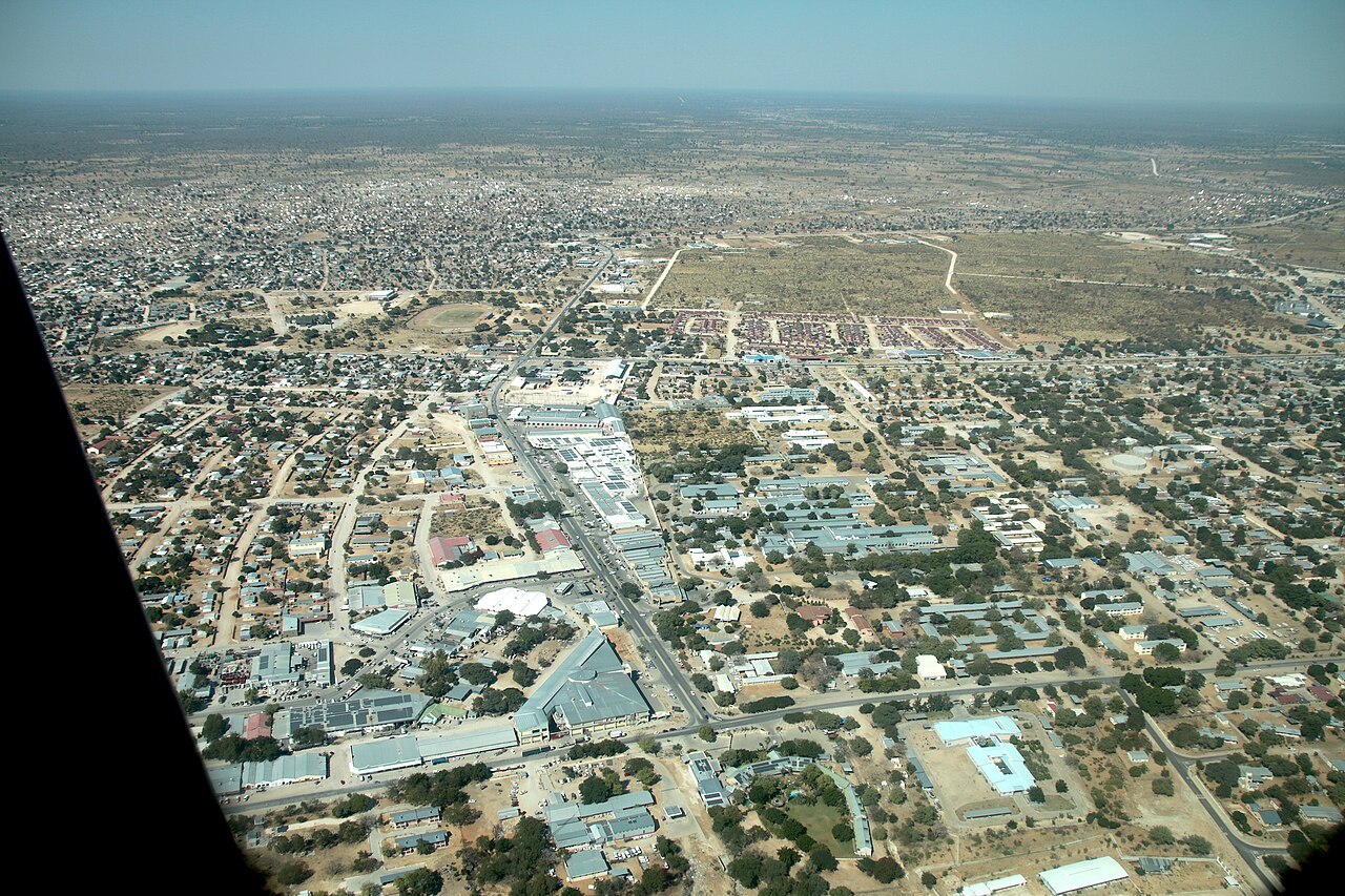
A fast-growing town on the banks of the Kavango River, which forms the border with Angola. Its population rose from about 37,000 in 2001 to about 119,000 in 2023, and it has been the seat of a Roman Catholic cathedral since 1993.

  • The Kavango River and the border with Angola
  • St Mary's Cathedral
  • The road east to the Caprivi Strip
Katima Mulilo
Photo: Eugen Zibiso, CC BY 2.0

Katima Mulilo

Zambezi, in the Caprivi Strip

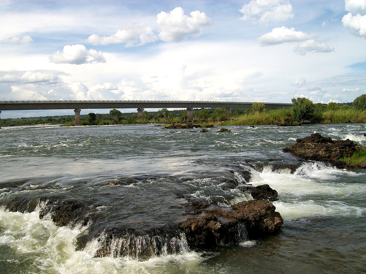
The easternmost town, on the Zambezi River at the end of the narrow Caprivi Strip, surrounded by green riverside forest with tropical birds and monkeys. It had about 46,000 people in 2023 and gets far more rain than the rest of the country.

  • The Zambezi River
  • The largest open market in Namibia
  • The bridge to Zambia, opened in 2004
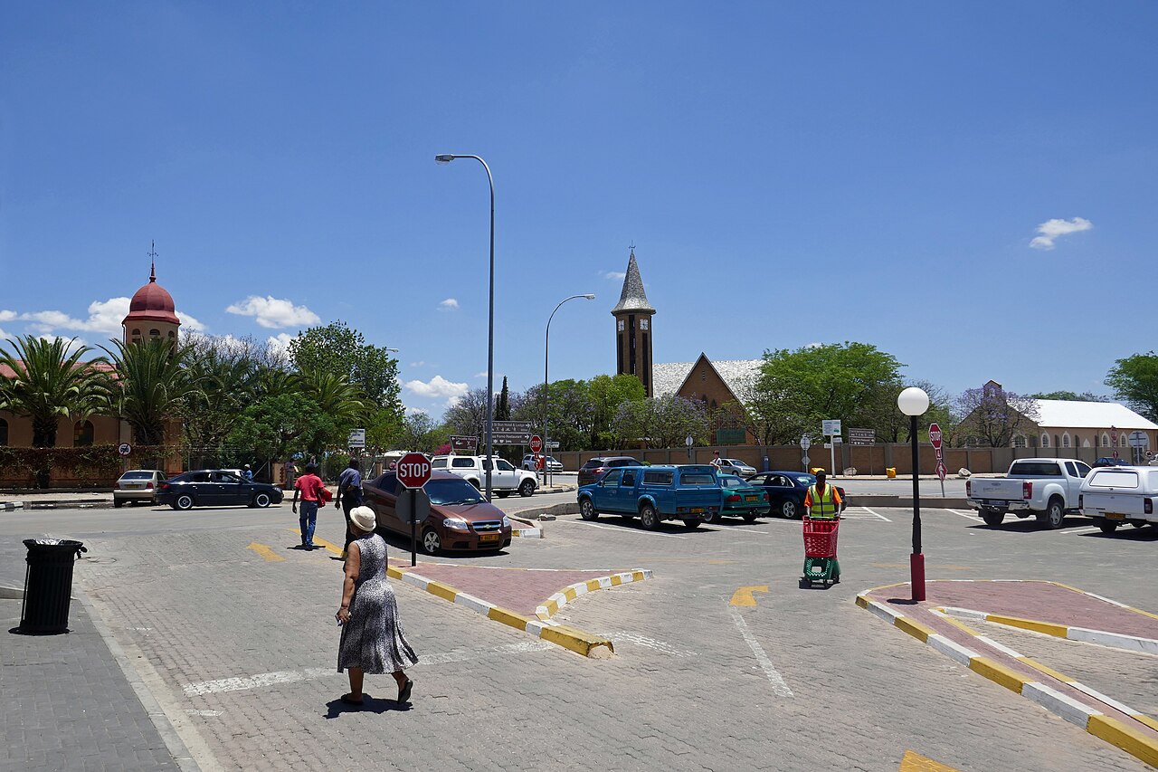
Otjiwarongo
Photo: Ji-Elle, CC BY-SA 4.0

Otjiwarongo

Otjozondjupa, in the centre-north

A farming and business town on the main road north from Windhoek, whose Otjiherero name means 'beautiful place'. It has many German-speaking residents. The Cheetah Conservation Fund has its research centre 44 km east of the town.

  • The Cheetah Conservation Fund
  • Game farms and nature reserves
  • A stop on the way to Etosha
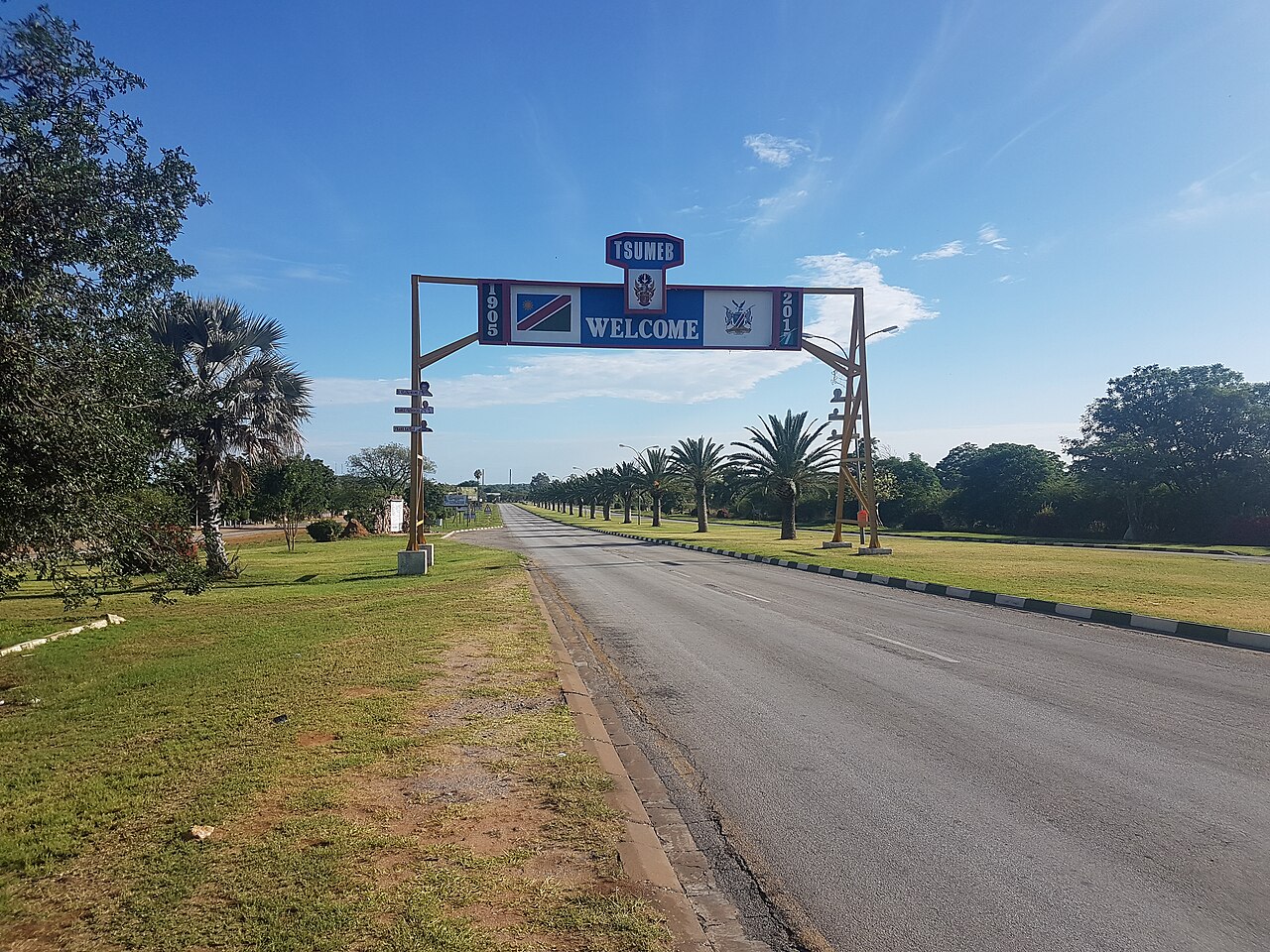
Tsumeb
Photo: Volly247, CC BY-SA 4.0

Tsumeb

Oshikoto, in the north

A mining town founded in 1905 around an extraordinary ore body that has yielded well over 170 different minerals, some found nowhere else. It is known as the 'gateway to the north' and is the closest town to Etosha National Park.

  • Rare mineral crystals
  • Its historic deep mine
  • The nearest town to Etosha
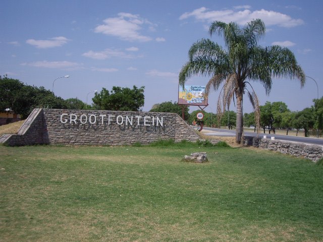
Grootfontein
Photo: Volly247, CC BY-SA 3.0

Grootfontein

Otjozondjupa, in the north

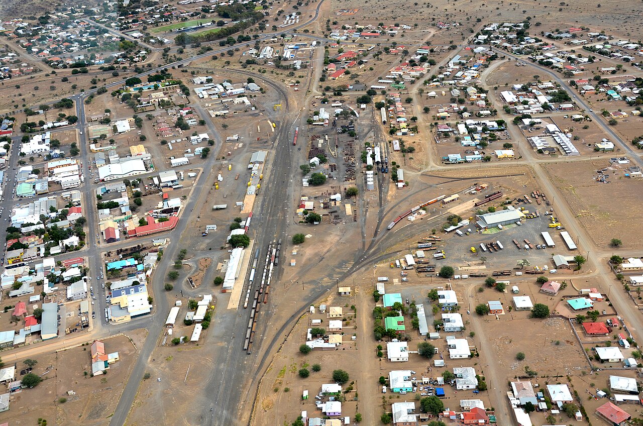
A town of about 27,000 people whose Afrikaans name means 'great fountain', after its spring. In 1885 Dorsland trekkers, Boer families travelling from the Transvaal, set up a short-lived republic here.

  • The Hoba meteorite nearby
  • Farming in the Otavi Triangle
  • The road east to the Caprivi Strip
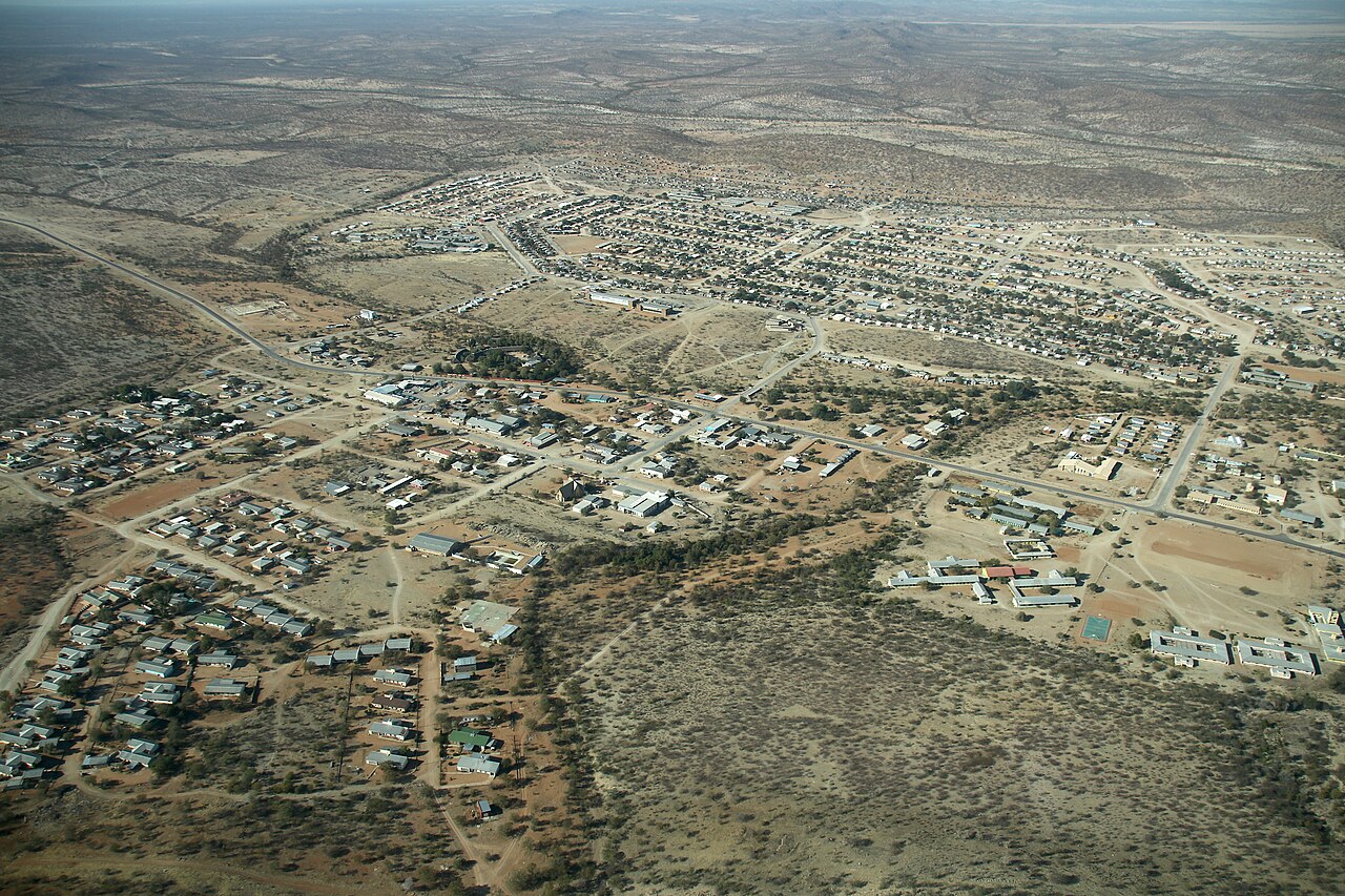
Khorixas
Photo: Hp.Baumeler, CC BY-SA 4.0

Khorixas

Kunene, in the northwest

A small town of about 9,000 people, most of them Damara, in the dry northwest. It is the nearest town to the Petrified Forest and a starting point for trips to the rock engravings of Twyfelfontein.

  • The Petrified Forest
  • The road to Twyfelfontein
  • Damara culture

Next: Landmarks

Landmarks

Places everyone should see once

Commons: Sossusvlei
Photo: Diego Delso, CC BY-SA 4.0
Near Walvis Bay

Sossusvlei

A white salt and clay pan surrounded by giant red dunes in the Namib-Naukluft National Park, where the Tsauchab River ends in the sand. Many dunes here are over 200 m high, and the highest, nicknamed Big Daddy, is about 325 m. The area is part of the Namib Sand Sea World Heritage Site. It lies about 210 km in a straight line southeast of Walvis Bay, and 60 km past the Sesriem park gate.

UNESCO World Heritage
Commons: Deadvlei
Photo: Giles Laurent, CC BY-SA 4.0
Near Walvis Bay

Deadvlei

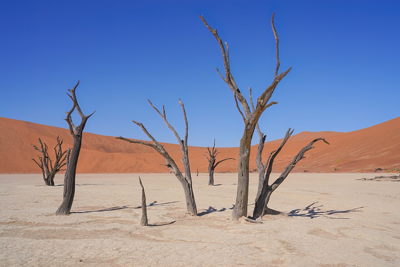
A white clay pan about 2 km from Sossusvlei, dotted with the black skeletons of camel thorn trees that died some 600 to 700 years ago when the dunes cut off the river. The air is so dry that the wood has not decayed. Its name means 'dead marsh'.

UNESCO World Heritage
Etosha National Park
Photo: Yathin S Krishnappa, CC BY-SA 3.0
Near Tsumeb

Etosha National Park

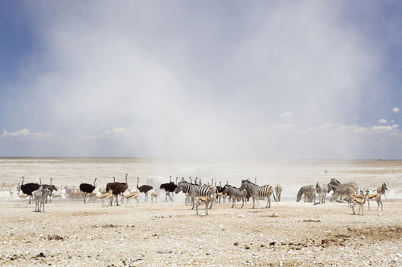
One of Africa's largest national parks, 22,270 km² of bush around the Etosha Pan, a vast salt pan of 4,760 km² whose name means 'great white place'. In the dry winter months elephants, lions, rhinos, giraffes and huge herds gather at its waterholes. The pin marks Namutoni, the eastern camp, about 90 km in a straight line from Tsumeb.

Fish River Canyon
Photo: RudiBosbouer, CC BY-SA 3.0
Near Keetmanshoop

Fish River Canyon

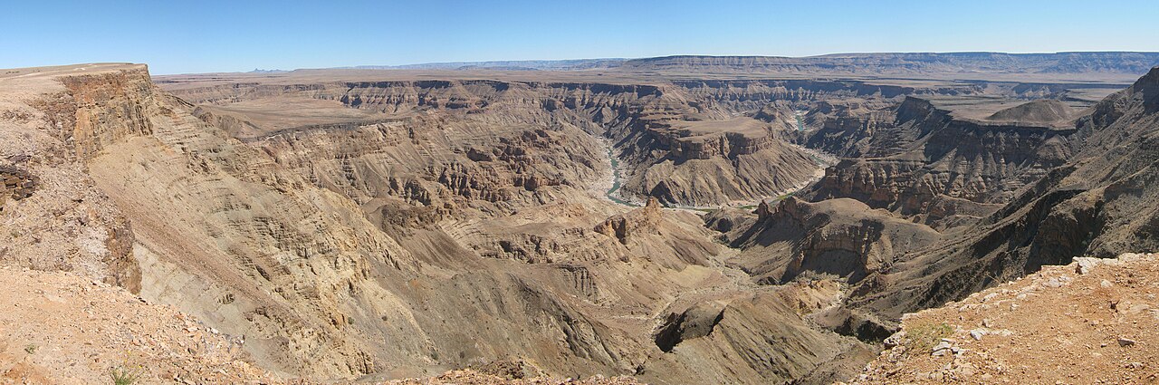
A gigantic ravine about 160 km long, up to 27 km wide and in places almost 550 m deep, often described as the largest canyon in Africa. The main viewpoints are near Hobas, about 125 km in a straight line south of Keetmanshoop, and the hot springs of Ai-Ais lie at its lower end.

Twyfelfontein
Photo: Mike from Vancouver, Canada, CC BY 2.0
Near Khorixas

Twyfelfontein

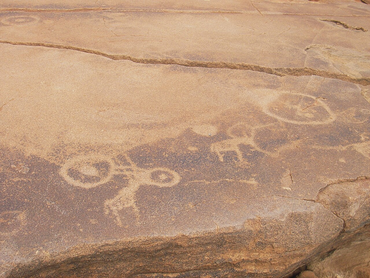
A valley around a spring where hunter-gatherers and later Khoekhoe herders carved at least 2,500 images of animals, footprints and symbols into the sandstone, one of the largest collections of rock engravings in Africa. It became Namibia's first World Heritage Site in 2007. It lies about 70 km in a straight line west of Khorixas.

UNESCO World Heritage
Kolmanskop
Photo: SkyPixels, CC BY-SA 4.0
Near Lüderitz

Kolmanskop

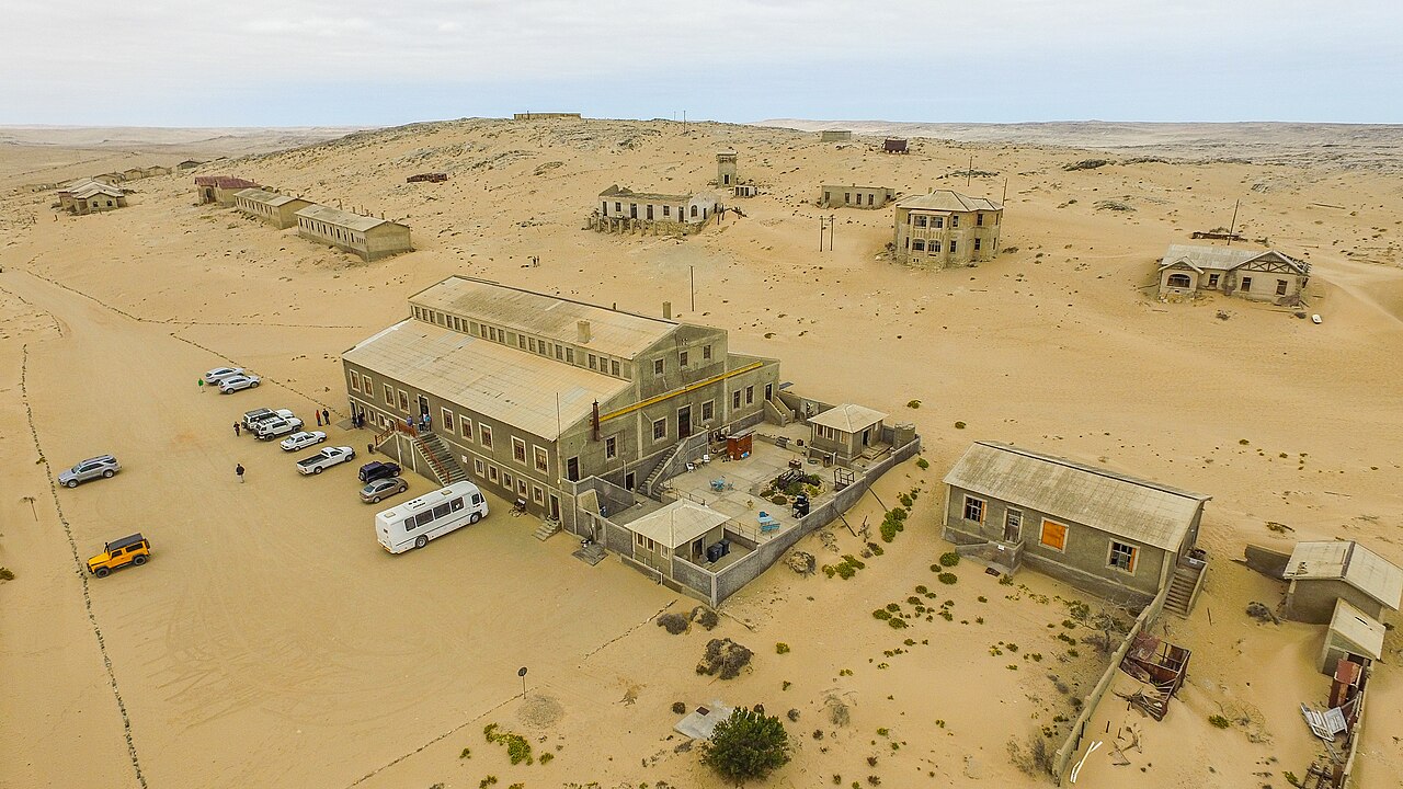
A ghost town about 10 km inland from Lüderitz, built by German diamond miners after 1908 with a hospital, ballroom, theatre and school. When richer diamond fields were found further south, the people left, and today the desert sand fills its empty houses.

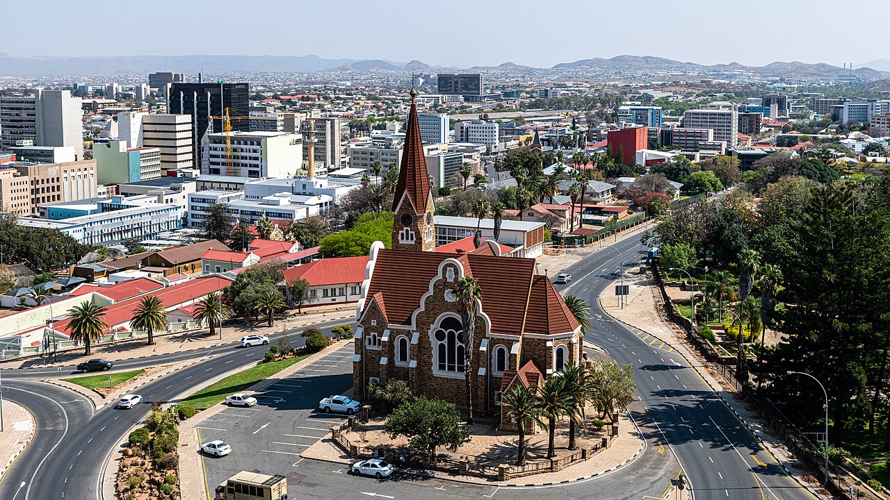
Commons: Christ Church Namibia
Photo: Diego Delso, CC BY-SA 4.0
Windhoek

Christ Church

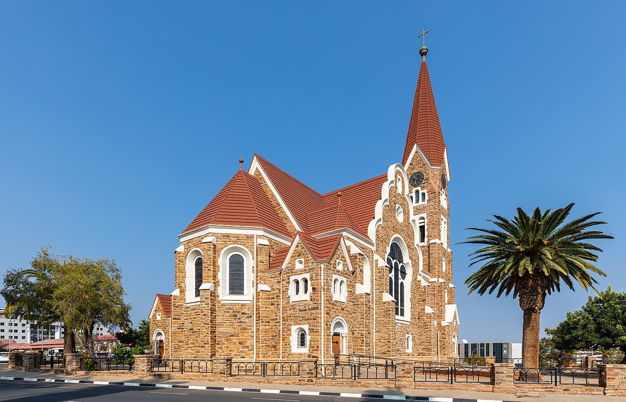
A Lutheran church dedicated in 1910, built of local sandstone with a portico of Italian marble and stained-glass windows given by Emperor Wilhelm II. It was first called the Church of Peace, after the wars between the Germans and the Herero and Nama. It stands on a traffic island near the Tintenpalast, the parliament building.

Cape Cross
Photo: betty x1138 from NYC, USA, CC BY 2.0
Near Swakopmund

Cape Cross

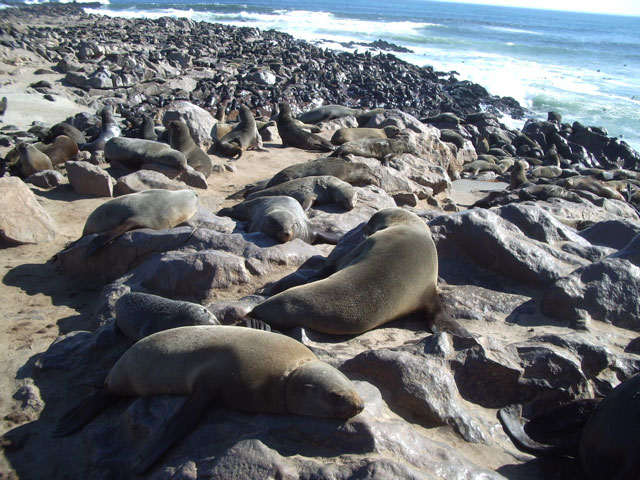
A headland on the Skeleton Coast, about 120 km in a straight line north of Swakopmund, where the Portuguese navigator Diogo Cão set up a stone cross in 1486. Replicas stand there now. It is also a seal reserve, home to one of the largest colonies of Cape fur seals in the world.

Spitzkoppe
Photo: Hp.Baumeler, CC BY-SA 4.0
Near Swakopmund

Spitzkoppe

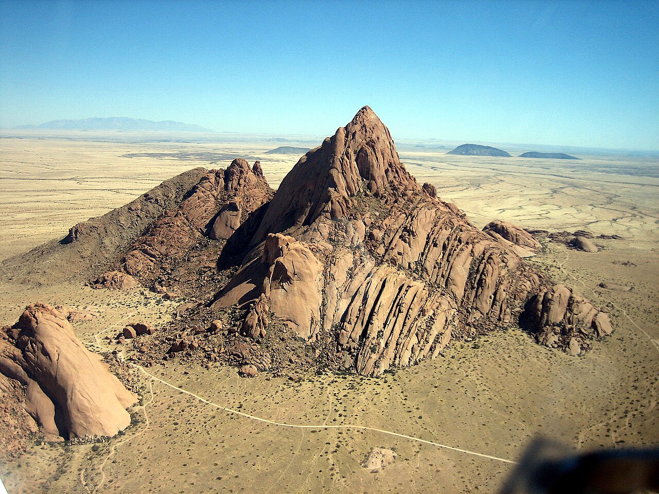
A group of bare granite peaks rising about 670 m above the flat desert, nicknamed the 'Matterhorn of Namibia'. The highest point is about 1,728 m above sea level, and San rock paintings can be seen in the area. It lies about 115 km in a straight line northeast of Swakopmund.

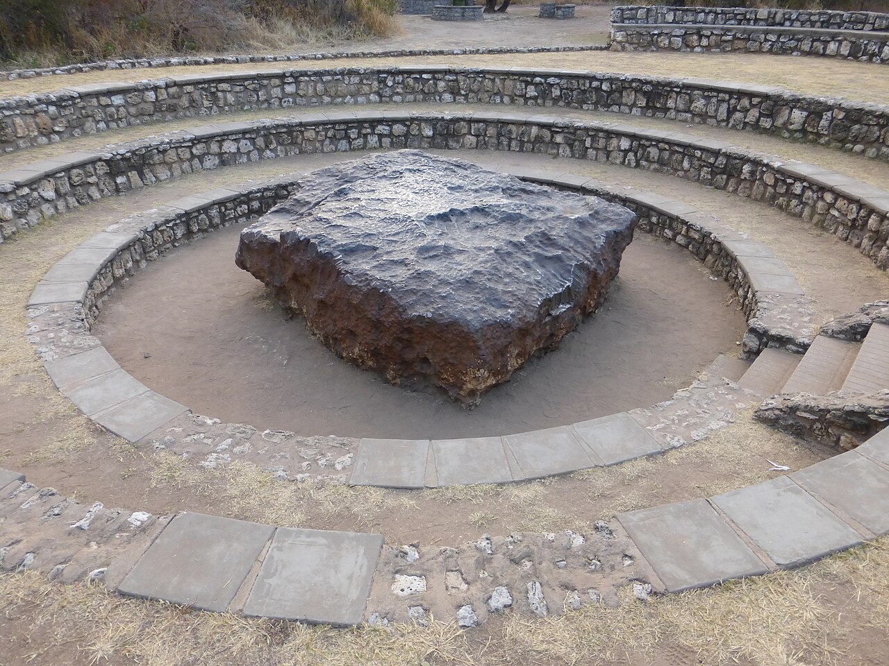
Hoba meteorite
Photo: Sergio Conti from Montevecchia (LC), Italia, CC BY-SA 2.0
Near Grootfontein

Hoba meteorite

A flat slab of iron and nickel about 2.7 m across and 0.9 m thick, weighing more than 60 tonnes, that fell less than 80,000 years ago and has never been moved. A farmer found it in 1920 when his plough struck it. It lies on a farm about 20 km west of Grootfontein.

Next: Fun facts

Fun facts

Things you might not know

  1. 01

    The country is named after the Namib Desert. The word Namib comes from the Khoekhoe language and is usually translated as 'vast place'.

  2. 02

    As of 2026, the Hoba meteorite near Grootfontein is the largest known meteorite in one piece, at more than 60 tonnes. It is so heavy that it has never been moved from the spot where it landed.

  3. 03

    As of 2026, Namibia is home to the largest population of wild cheetahs in the world, and most of them live on farmland rather than in parks.

  4. 04

    Namibia is one of the few countries that writes the protection of nature into its constitution: Article 95 commits the state to keeping ecosystems and wildlife healthy for present and future Namibians.

  5. 05

    As of 2026, Namibia is one of the most thinly populated countries in the world, with fewer than 4 people per square kilometre.

  6. 06

    The welwitschia, a desert plant that grows only two leaves in its whole life, can live for well over a thousand years. It appears on Namibia's coat of arms.

  7. 07

    The dead camel thorn trees of Deadvlei have been standing for about 600 to 700 years; the desert air is so dry that their wood has not rotted away.

  8. 08

    The Skeleton Coast takes its name from the whale and seal bones that once covered its beaches and from the many shipwrecks along it. The name became popular through a book published in 1944.

  9. 09

    Himba women in the northwest cover their skin and hair with otjize, a paste of butterfat and red ochre that gives them their famous reddish colour.

  10. 10

    Married Herero women often wear long, high-necked dresses with many petticoats, adapted from the fashions of the German colonial era, together with a headdress shaped like the horns of a cow.

  11. 11

    The Tropic of Capricorn cuts Namibia roughly in half, and the country gets more than 300 days of sunshine a year.

  12. 12

    The Namibian dollar is always worth exactly one South African rand, and shops in Namibia accept both.

  13. 13

    Namibia's flag, adopted at independence on 21 March 1990, shows a golden sun with twelve rays in a blue triangle, divided from a green triangle by a red band edged in white.

Next: Words

Oshiwambo (Kwanyama) and Afrikaans words

20 words to start with

Most words here are in Oshikwanyama, one of the two written forms of Oshiwambo, Namibia's most common home language. Afrikaans is spoken as a shared language by many Namibians. Pronunciation is written the way it sounds; the capital letters show where the stress goes. Audio is coming soon.

Greetings

  • wa lele po? (Oshikwanyama)wah LEH-leh pohgood morning (literally 'did you lie down well?')
  • wa uhala po? (Oshikwanyama)wah oo-HAH-lah pohgood afternoon
  • ongiini? (Oshikwanyama)ong-GEE-neehello, how is it? (informal)
  • tangi unene (Oshikwanyama)TAHN-gee oo-NEH-nehthank you very much
  • ehee (Oshikwanyama)eh-HEHyes
  • ahowe (Oshikwanyama)ah-HOH-wehno
  • dankie (Afrikaans)DUN-keethanks

Numbers

  • imwe (Oshikwanyama)EEM-wehone
  • mbali (Oshikwanyama)m-BAH-leetwo
  • nhatu (Oshikwanyama)n-HAH-toothree

Food and drink

  • omeva (Oshikwanyama)oh-MEH-vahwater
  • ombelela (Oshikwanyama)om-beh-LEH-lahmeat
  • omahangu (Oshikwanyama)oh-mah-HAHN-goopearl millet
  • oukuki (Oshikwanyama)oh-oo-KOO-keefat cakes
  • lekker (Afrikaans)LEK-ernice, tasty, great

People

  • meme (Oshikwanyama)MEH-mehmother; also a respectful way to address a woman
  • tate (Oshikwanyama)TAH-tehfather; also a respectful way to address a man
  • meekulu (Oshikwanyama)meh-eh-KOO-loograndmother, a very respectful form of address
  • kaume (Oshikwanyama)kah-OO-mehfriend

Around town

  • robot (Namibian English)ROH-bottraffic light

Next: Phrases

Say it like a local

Useful phrases

Oshiwambo greetings are questions: the polite reply is 'Ehee' (yes). Greet first, before asking anything.

Wa lele po?
wah LEH-leh poh
Good morning (did you sleep well?)
Greeting someone in the morning in Oshikwanyama. The reply is 'Ehee'
Wa uhala po?
wah oo-HAH-lah poh
Good afternoon
Greeting someone around midday and in the afternoon
Wa tokelwa po?
wah toh-KEL-wah poh
Good evening
Greeting someone in the evening
Nawa tuu?
NAH-wah TOO
Are you well?
Asking after someone's health after the greeting
Onawa.
oh-NAH-wah
I'm fine.
Answering 'Nawa tuu?'
Tangi unene.
TAHN-gee oo-NEH-neh
Thank you very much.
Thanking someone for help, a gift or a meal
Oikulya inyenye!
oy-KOOL-yah een-YEN-yeh
The food is very good!
Praising a meal you have been served
Omeva oku li peni?
oh-MEH-vah oh-koo lee PEH-nee
Where is the water?
Asking for water, for example to wash your hands before a meal
Kandi udite ko.
KAHN-dee oo-DEE-teh koh
I don't understand.
When you cannot follow what someone says
Kala po nawa.
KAH-lah poh NAH-wah
Stay well (goodbye).
Saying goodbye to someone who is staying while you leave
Enda po nawa.
EN-dah poh NAH-wah
Go well (goodbye).
Saying goodbye to someone who is leaving
Goeie môre.
KHOO-yeh MAW-ruh
Good morning (Afrikaans)
Greeting someone in the morning in Afrikaans, common in the south and centre
Hoe gaan dit?
hoo KHAHN dit
How are you? (Afrikaans)
Asking after someone, as Namibians do before any business
Goed, dankie.
khoot DUN-kee
Fine, thanks. (Afrikaans)
Answering 'Hoe gaan dit?'
Asseblief.
AH-suh-bleef
Please. (Afrikaans)
Asking for something politely
Hoeveel kos dit?
HOO-feel kos dit
How much is this? (Afrikaans)
Asking a price at a shop or market
Die rekening, asseblief.
dee REE-uh-kuh-ning AH-suh-bleef
The bill, please. (Afrikaans)
Asking for the bill in a restaurant
Totsiens.
TOT-seens
Goodbye. (Afrikaans)
Saying goodbye in Afrikaans

Next: Local tips

Local tips

Before you go

Drive on the left, and take gravel roads slowly

Traffic keeps to the left. Most roads outside towns are gravel: the UK government advises no more than 80 km/h on them, especially in the rainy season, carrying two spare tyres, and not driving outside towns at night, when wildlife and livestock wander onto the road.

Carry water and fill up often

Towns and petrol stations can be hundreds of kilometres apart. Carry plenty of drinking water and some food, fill your tank whenever you can, and have cash for small payments in the countryside, such as a tip for the petrol attendant.

Know the emergency numbers

As of 2026, the UK government lists 10111, 999 and 112 as emergency numbers in Namibia for the police, ambulance and fire service.

Check malaria advice for the north

As of 2026, TravelHealthPro lists a high malaria risk all year in the Kavango East, Kavango West and Zambezi regions, and from December to April in other northern regions, including the area of Etosha. The south, Windhoek and the coast have a very low risk. See a doctor or travel clinic before you go.

Greet before anything else

Namibians greet and ask how you are before any question or business, even in a shop or on the phone. Greet older people first, and take time to shake hands.

Money: Namibian dollars and rand

The Namibian dollar and the South African rand are used side by side at the same value, and change is usually given in Namibian dollars. Outside Namibia, Namibian dollars are hard to exchange, so spend or change them before you leave.

Ask before taking photos

Always ask before photographing people, including in Himba and Herero communities. Do not photograph government buildings or security areas without permission: people have been detained for photographing the President's official residence.

You have seen it all: take the quiz

Sources (76)