A narrow land bridge between two oceans, where ships climb over the hills through a famous canal, old forts guard the Caribbean shore, and rainforest begins just outside the capital.
Panama is the narrow, S-shaped country that joins Central America to South America. Costa Rica lies to the west and Colombia to the southeast, the Caribbean Sea washes its northern coast and the Pacific Ocean its southern one. A spine of mountains runs down the middle, rising to Volcán Barú, about 3,475 m high. The climate is tropical and warm all year, with a long rainy season from about May to November and a shorter dry season from about December to April. Around 40 percent of the land is still covered by forest.
Indigenous peoples such as the Guna, Emberá and Ngäbe lived here long before Europeans came. In 1513 the Spaniard Vasco Núñez de Balboa crossed the isthmus and saw the Pacific, and for almost 300 years Panama was the route by which Spain carried gold and silver from Peru to the Caribbean ports. Panama broke away from Spain in 1821 and joined Gran Colombia, then separated from Colombia in 1903 with the backing of the United States, which built the Panama Canal and opened it in 1914. Panama took full control of the canal on 31 December 1999.
Questions to ask the older generation
Memories fade faster than photos. Ask these over a meal or a phone call, and write the answers down.
Which town or region of Panama did our family come from? Was it near Colón, Portobelo, La Chorrera?
Who was the first in the family to leave Panama, when, and why?
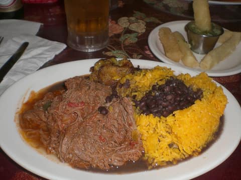
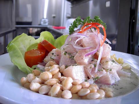
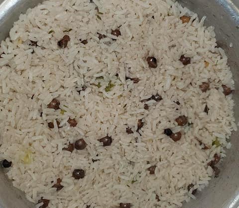
Which dishes from Panama were cooked at home? Did anyone make Ropa vieja or Fried fish with coconut rice?
Does anyone in the family still speak Spanish, or use a few words of it?
Were there songs, prayers, games or holidays from Panama that the family kept?
Are there old photos, letters or documents from Panama? Who has them?
If you could visit Panama together, where would you go first?
A short history of Panama
The Isthmus of Panama rose from the sea about three million years ago and joined two continents. Its peoples made some of the earliest pottery in the Americas. From the 1500s it was Spain's crossing point between the oceans, a prize for pirates and privateers, and later the site of a railway and one of the greatest engineering works in the world, the Panama Canal. The 20th century was shaped by the long struggle over who should control the canal, which ended when Panama took it over in 1999.
1513
Balboa sees the Pacific
On 25 September 1513 the Spanish explorer Vasco Núñez de Balboa, guided by local Indigenous people, crossed the isthmus from the Caribbean side and became the first known European in the Americas to see the Pacific Ocean. He called it the South Sea. Panama's currency, the balboa, is named after him.
1597
Portobelo is founded
In 1597 the Spanish founded Portobelo on the Caribbean coast because of its deep natural harbour. It replaced Nombre de Dios as the port where Peruvian silver was loaded onto Spain's treasure fleets, and it held great trade fairs when the fleets arrived. Forts were built to protect it, but English privateers still captured it several times.
1698
The Scottish Darien scheme
In 1698 settlers from Scotland founded a colony called New Caledonia on the Caribbean coast of Darién, hoping to control a trade route between the oceans. Disease, hunger and a Spanish siege ended it by March 1700, and most of the settlers died. The huge financial losses helped push Scotland into union with England in 1707.
1855
The Panama Railway opens
On 28 January 1855 the first train ran the full length of a new railway from Colón on the Caribbean to Panama City on the Pacific, about 76 km. It was built mainly for travellers heading to the California gold rush, and thousands of workers died building it in the jungle. It is often called the first transcontinental railway.
1903
Panama separates from Colombia
After Colombia's Senate rejected a canal treaty with the United States, Panama declared its separation from Colombia on 3 November 1903, with American support. Weeks later a treaty gave the United States a zone about 16 km wide across the isthmus, where it could build and run a canal 'in perpetuity'. This zone became the Panama Canal Zone.
1964
Martyrs' Day
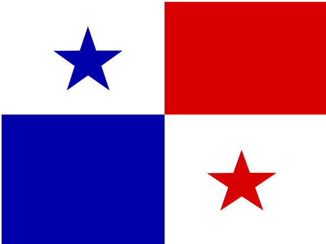
On 9 January 1964 Panamanian students entered the Canal Zone to fly their national flag beside the American flag at a school. In the scuffle that followed, the Panamanian flag was torn, and three days of riots left about 22 Panamanians and four US soldiers dead. 9 January is now a day of national mourning, and the events led to talks about returning the canal.
1989
The United States invades Panama
From 1968 Panama was under military rule, and in the 1980s General Manuel Noriega held power. In May 1989 he annulled an election won by the opposition. On 20 December 1989 US forces invaded; Noriega surrendered on 3 January 1990 and was taken to the United States for trial. Hundreds of Panamanians died, and estimates of the number vary widely. The elected president took office, and Panama replaced its army with police and border forces.
2016
The expanded canal opens
In a referendum in 2006, 76.8 percent of voters approved building a third, wider lane of locks. The expanded canal opened on 26 June 2016 and doubled the canal's capacity, letting through much larger ships, called Neopanamax ships.
guialGYAHLgirl, young woman (from the English word)
guachimángwah-chee-MAHNsecurity guard, watchman (from the English word)
Everyday life
vainaBAI-nahthing, stuff, business (very informal)
pritiPREE-teepretty, nice (from the English word)
Towns and regions
Panama City, Panamá: Casco Viejo, the old quarter, and the ruins of Panamá Viejo, The Miraflores Locks of the canal on the edge of the city.
Colón, Colón: The Colón Free Trade Zone, a huge duty-free trading area opened in 1948, The Agua Clara and Gatún locks nearby.
Portobelo, Colón: Colonial forts and the old royal customs house, The Black Christ festival every 21 October.
La Chorrera, Panamá Oeste: Bollos and chicheme, Its yearly international fair.
Penonomé, Coclé: A legend about the chief Nomé, who resisted the Spanish, The cathedral on the central square.
Santiago de Veraguas, Veraguas: A stop on the Pan-American Highway between Panama City and David, Shops, offices and schools for the whole of Veraguas province.
Chitré, Herrera: Holy Week and the feast of San Juan Bautista, Its carnival.
Las Tablas, Los Santos: A famous carnival where Calle Arriba and Calle Abajo compete, Folk music, dance, food and crafts.
David, Chiriquí: The gateway to Boquete and Volcán Barú, The economic centre of Chiriquí province.
Boquete, Chiriquí: Coffee farms, including the famous Geisha coffee, Hiking trails and the climb up Volcán Barú.
Bocas del Toro, Bocas del Toro: Island beaches and coral reefs, Isla Bastimentos National Marine Park.
Yaviza, Darién: The end of the road: the start of the Darién Gap, Boat travel on the Chucunaque and Tuira rivers.